History of the JPA
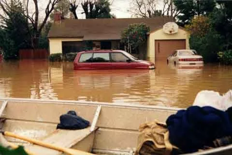
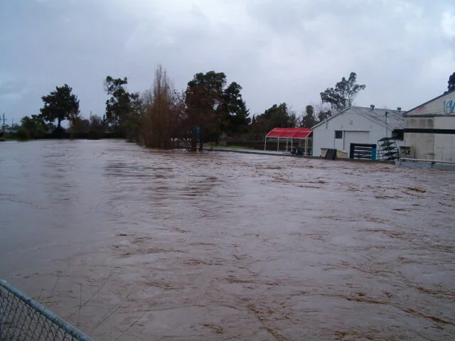
Following years of effort to address environmental issues, and the flood of record in 1998 that damaged approximately 1,700 properties, five local agencies from two counties—the cities of Palo Alto, Menlo Park, and East Palo Alto, the County of San Mateo, and the Santa Clara Valley Water District— came together and in 1999 created a new regional government agency, the San Francisquito Creek Joint Powers Authority (SFCJPA). Elected officials represent these jurisdictions on the SFCJPA Board, the JPA employs an executive director and three professional staff, who are substantially assisted by consultants and by the staff of its founding agencies.
Planning, design and funding complex projects in sensitive environments can take a long time, and requires the engagement of many experts, regulatory agencies and the input of many community members.
An important milestone in the history of the JPA has been the completion in 2019 of the Downstream Project in Reach 1, the segment of the creek from Highway 101 to the San Francisco Bay. Working upstream from the end of the creek where it meets the Bay, the next project work on the creek will be in Reach 2, focusing on channel widening and bridge replacements in the section from Highway 101 to the Pope-Chaucer bridge.
The JPA is also addressing the threat of flooding from the Bay. As high tides and rising seas imperil communities on the Bay margin, the JPA has taken a leadership role in the SAFER Bay project (Strategy to Advance Flood protection, Ecosystems and Recreation along San Francisco Bay). This project will rebuild or construct new levees or other flood and sea level rise resiliency measures.